Dessenheim
Prijeđi na navigaciju
Prijeđi na pretragu
| Desenhajm Dessenheim | |
|---|---|
 Grb | |
| Osnovni podaci | |
| Država | |
| Region | Alzas |
| Departman | Haut-Rhin |
| Okrug | Kolmar |
| Kanton | Nef Brizah |
| Stanovništvo | |
| Stanovništvo (2011-01-01) | 1.234[1] |
| Gustina stanovništva | 64,41 st./km² |
| Geografija | |
| Koordinate | 47°58′35″N 7°29′21″E / 47.9763888888889°N 7.48916666666667°E |
| Vremenska zona | UTC+1, ljeti UTC+2 |
| Nadmorska visina | 200 m |
| Površina | 19,16 km² |
| Ostali podaci | |
| Poštanski kod | 68600 |
| INSEE kod | 68069 |
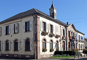
Desenhajm (fr. Dessenheim) je naselje i opština u istočnoj Francuskoj u regionu Alzas, u departmanu Gornja Rajna koja pripada prefekturi Kolmar.
Po podacima iz 1999. godine u opštini je živelo 1050 stanovnika, a gustina naseljenosti je iznosila 54 stanovnika/km². Opština se prostire na površini od 19,16 km². Nalazi se na srednjoj nadmorskoj visini od 200 metara (maksimalnoj 207 m, a minimalnoj 197 m).
Demografija[uredi | uredi kod]
| 1962. | 1968. | 1975. | 1982. | 1990. | 1999. | 2011. |
|---|---|---|---|---|---|---|
| 698 | 756 | 817 | 830 | 928 | 1.050 | 1.234 |
- Grafik promene broja stanovnika u toku poslednjih godina

Vidi još[uredi | uredi kod]
- Departmani Francuske
- Spisak departmana Francuske po gustini naseljenosti
- Spisak departmana Francuske po površini
- Spisak departmana Francuske po broju stanovnika
- Spisak opština u departmanu Gornja Rajna
Reference[uredi | uredi kod]
Literatura[uredi | uredi kod]
- Alexandra Hughes, Alex Hughes, Keith A Reader, Keith Reader, ur. (2001). Encyclopedia of Contemporary French Culture (Routledge; Routledge World Reference edition izd.). ISBN 0415263549.
- Robb, Graham (2008). The Discovery of France: A Historical Geography. W. W. Norton & Company. ISBN 0393333647.
- Ardagh, John (1991). France (Cultural Atlas of izd.). Facts on File. ISBN 081602619X.
- Jones, Colin (1999). The Cambridge Illustrated History of France (Cambridge Illustrated Histories izd.). Cambridge University Press. ISBN 0521669928.
- Sowerwine, Charles (2009). France since 1870: Culture, Society and the Making of the Republic (2nd izd.). Palgrave Macmillan. ISBN 0230573398.
- Roberts, William J. (2004). France: A Reference Guide from the Renaissance to the Present (European Nations) (European Nations izd.). Facts on File. ISBN 0816044732.
Vanjske veze[uredi | uredi kod]
- Baza podataka: Insee (fr)
- Desenhajm na stranici Nacionalnog geografskog instituta Francuske (fr)
- Desenhajm na stranici organizacije INSEE (fr)
- Najbliža naselja (kilometraža, pravac i koordinate)[mrtav link] (fr)
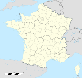
- Položaj mesta Desenhajm na mapi Francuske (sa osnovnim podacima o mestu)[mrtav link] (fr)
- Plan naselja Desenhajm na mapi (Mapquest)
Koordinate: 47° 58' 35" SG Š, 07° 29' 21" IGD


