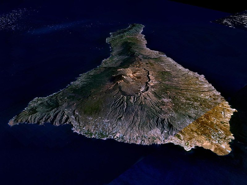
Datoteka:Nasa world wind - teneriffa.jpg
Prijeđi na navigaciju
Prijeđi na pretragu

Veličina ovog prikaza: 800 × 599 piksela. Druge rezolucije: 320 × 240 piksela | 640 × 479 piksela | 1.024 × 766 piksela | 1.280 × 958 piksela.
Izvorna datoteka (1.280 × 958 piksela, veličina datoteke/fajla: 120 kB, MIME tip: image/jpeg)
Historija datoteke
Kliknite na datum/vrijeme da biste vidjeli tadašnju verziju datoteke.
| Datum/vrijeme | Minijatura | Dimenzije | Korisnik | Komentar | |
|---|---|---|---|---|---|
| aktualna | 03:15, 31 mart 2005 |  | 1.280 × 958 (120 kB) | Simplicius | {{NASA-PD}} Teneriffa from the west side. One sees Teide (3,700 meters) and the Caldera (2,000 m). To the right hand the new airport. On the left side one sees that there is more humidity and therefore vegetation at the north side of the island. |
Upotreba datoteke
Sljedeća stranica koristi ovu datoteku:
Globalna upotreba datoteke
Ovu datoteku upotrebljavaju i sljedeći projekti:
- Upotreba na projektu ar.wikipedia.org
- Upotreba na projektu be-tarask.wikipedia.org
- Upotreba na projektu cs.wikipedia.org
- Upotreba na projektu de.wikipedia.org
- Upotreba na projektu de.wikinews.org
- Upotreba na projektu de.wikivoyage.org
- Upotreba na projektu en.wiktionary.org
- Upotreba na projektu eo.wikipedia.org
- Upotreba na projektu es.wikipedia.org
- Upotreba na projektu fa.wikipedia.org
- Upotreba na projektu fi.wikipedia.org
- Upotreba na projektu frr.wikipedia.org
- Upotreba na projektu fy.wikipedia.org
- Upotreba na projektu gl.wikipedia.org
- Upotreba na projektu he.wikipedia.org
- Upotreba na projektu hu.wikipedia.org
- Upotreba na projektu incubator.wikimedia.org
- Upotreba na projektu it.wikipedia.org
- Upotreba na projektu mn.wikipedia.org
- Upotreba na projektu nn.wikipedia.org
- Upotreba na projektu no.wikipedia.org
- Upotreba na projektu pl.wiktionary.org
- Upotreba na projektu ru.wikipedia.org
- Upotreba na projektu sk.wikipedia.org
- Upotreba na projektu sw.wikipedia.org
- Upotreba na projektu tr.wikipedia.org
- Upotreba na projektu uk.wikipedia.org
- Upotreba na projektu vi.wikivoyage.org
- Upotreba na projektu zgh.wikipedia.org
