Datoteka:Chile-Chonos Archipelago.jpg
Izvorna datoteka (1.032 × 1.276 piksela, veličina datoteke/fajla: 572 kB, MIME tip: image/jpeg)
Opis izmjene
| Opis |
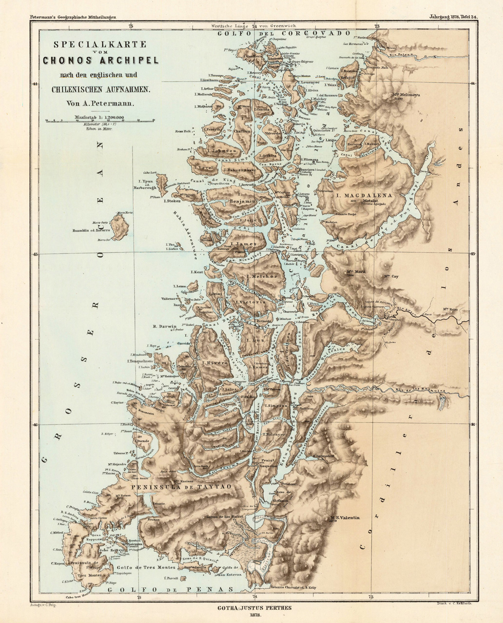
English: Lithograph, printed in colors when published. Detailled map, showing the Chonos Archipel from the gulf of Penas with the Peninsula de Taytao up to the gulf of Corcovado. Very detailled map with an enormous number of islands and peninsulas, most of them with place names. The map provides an overview of the results of the travel by Th. von Heugelin to Somalia. It is also ornated with a scene of birds and mammals, which were discovered by Th. Heugelin in Somalia. |
| Datum | |
| Izvor | http://www.bergbook.com/htdocs/woda/data/demo/descriptions/17333.htm |
| Autor | Petermann, A. |
Licenciranje
|
Ovo je djelo u javnom vlasništvu u zemlji podrijetla i u drugim zemljama s rokom trajanja autorskih prava za života autora plus 70 godina ili manje.
| |
| Ova datoteka je identificirana kao slobodna od poznatih ograničenja po zakonu o autorskim pravima, uključujući sva povezana i srodna prava. | |
Historija datoteke
Kliknite na datum/vrijeme da biste vidjeli tadašnju verziju datoteke.
| Datum/vrijeme | Minijatura | Dimenzije | Korisnik | Komentar | |
|---|---|---|---|---|---|
| aktualna | 04:43, 24 februar 2010 | | 1.032 × 1.276 (572 kB) | Rec79 | {{Information |Description={{en|1=Lithograph, printed in colors when published. Detailled map, showing the Chonos Archipel from the gulf of Penas with the Peninsula de Taytao up to the gulf of Corcovado. Very detailled map with an enormous number of islan |
Upotreba datoteke
Sljedeća stranica koristi ovu datoteku:
Globalna upotreba datoteke
Ovu datoteku upotrebljavaju i sljedeći projekti:
- Upotreba na projektu ca.wikipedia.org
- Upotreba na projektu de.wikipedia.org
- Upotreba na projektu en.wikipedia.org
- Upotreba na projektu es.wikipedia.org
- Upotreba na projektu fr.wikipedia.org
- Upotreba na projektu fr.wiktionary.org
- Upotreba na projektu gl.wikipedia.org
- Upotreba na projektu it.wikipedia.org
- Upotreba na projektu lt.wikipedia.org
- Upotreba na projektu lv.wikipedia.org
- Upotreba na projektu nn.wikipedia.org
- Upotreba na projektu ru.wikipedia.org
- Upotreba na projektu www.wikidata.org