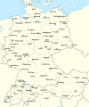
Datoteka:Rzeczpospolita 1937.svg

Izvor: Wikipedija
Prijeđi na navigaciju Prijeđi na pretragu

Izvorna datoteka(SVG fajl, nominalno 2.220 × 1.554 piksela, veličina fajla: 573 kB)

Ova datoteka je s projekta Vikimedijina ostava i može se upotrebljavati i na drugim projektima. Ispod su prikazane informacije s njene opisne stranice.

Opis izmjene

Opis Test version of a vectorized File:Rzeczpospolita 1920.png; more changes will follow, only checking if wiki displays it right
Datum
Izvor

Vlastito djelo; based on an earlier raster map made in 2005, as well as similar maps made by myself in 2004 (see below).
In preparation of this map I used many other maps as sources and backup. Among them were:

  • a German roadmap of Poland printed in 1938 (colours and the shape of East Prussian border)
  • and perhaps a dozen others.
Autor Halibutt
Ostale verzije
SVG genesis
InfoField
 
Izvorni kôd ove SVG-datoteke nije valjan zbog 2 grešaka.
 
Ova je vektorska slika napravljena programom Adobe Illustrator,
 
and with Inkscape.
 
 This map uses embedded text that can be easily translated using a text editor.


Copyright notice: Image made by Halibutt and uploaded to Wikipedia by the author. Images can be made available for use under other copyleft licenses on a case by case basis via direct contact with the author. Under moral rights the user requires that this work be properly attributed to its creator. For photographs, this is traditionally done in the image caption. Where a copyright notice is present, using the copyright notice in the caption will be sufficient. Note that the GFDL requires that any copyright notices be included with the work even when making unmodified use of it.

Since the legal status of the above comment has been questioned, I hereby grant anyone the right to treat it as either a standard copyright notice, invariant section, legal statement, legal advice, friendly suggestion or a mere comment, depending on his or hers own choice.
Halibutt
GNU head Dopušteno je umnožavanje, dijeljenje i mijenjanje ovog dokumenta pod uslovima GNU-ove licence za slobodnu dokumentaciju, verzije 1.2 ili bilo koje novije koju objavi Fondacija za slobodni softver; bez nepromjenljivih odjeljaka i bez tekstova na naslovnoj i zadnjoj strani. Tekst licence možete pročitati ovdje.
w:bs:Creative Commons
pripisivanje dijeljenje pod istim uslovima
Ova datoteka dostupna je pod licencom Creative Commons Attribution-Share Alike 3.0 Unported licencom.
Slobodno smijete:
  • dijeliti – umnožavati, raspodjeljivati i prenositi djelo
  • prerađivati – prilagođavati djelo
Pod sljedećim uslovima:
  • pripisivanje – Morate pripisati odgovarajuće autorske zasluge, osigurati link ka licenci i naznačiti jesu li napravljene izmjene. To možete uraditi na bilo koji razumni način, ali ne tako da se sugerira da davalac licence odobrava Vas ili Vašu upotrebu njegovog djela.
  • dijeljenje pod istim uslovima – Ako mijenjate, transformišete ili nadograđujete ovaj materijal, morate ga objaviti i distribuirati samo pod istom ili sličnom licencom poput ove.
Ova oznaka licence je dodana na ovu datoteku kao dio GFDL ažuriranja licence.

The following is a list of maps created by Halibutt and uploaded to commons, as well as their present and projected derivatives.

Parent Image Image Description
  Maps by Halibutt
Image:Rzeczpospolita.png Image:Rzeczpospolita.png The Republic in 17th and 18th century
Image:Rzeczpospolita 1600.png The Republic after the Treaty of Dywilino
Image:Rzeczpospolita voivodships.png Voivodships of The Republic
Image:Rzeczpospolita_Potop.png The Republic during The Deluge and Chmielnicki Uprising, with major battles of the era marked
Magnates and their lands and domains
1st2nd3rd Partitions of Poland
War of the constitution
Image:Rzeczpospolita.xcf SOURCE FILE - GIMP format
Image:Poland 1939.png Image:Poland 1939.png Poland in 1939
Image:Dywizje wrzesien 1.png Order of Battle on September 1st, during the Polish Defence War of 1939
Image:Poland 1939.xcf SOURCE FILE - GIMP format
Image:Polska kontur bialy.png Image:Polska kontur bialy.png Contour map of Poland AD 1999, for use with various locator maps
Image:Rzeczpospolita 1923.png Image:Rzeczpospolita 1923.png Map of Poland 1918-1939, currently under development
Image:PBW March 1919.png Polish-Bolshevik War - fronts in March of 1919
Image:PBW December 1919.png Polish-Bolshevik War - fronts in December of 1919
Image:PBW June 1920.png Polish-Bolshevik War - fronts in July of 1920
Image:PBW August 1920.png Polish-Bolshevik War - fronts in August of 1920
Polish Defence War of 1939
Polish areas annexed by Germany, Lithuania, Slovakia and the Soviet Union
German concentration camps in Poland
Curzon line
Major battles of the Polish-Bolshevik War
namesno names Polish/Czechoslovak/Lithuanian/German/Ukrainian claims in 1920's
Image:Rzeczpospolita Central Lithuania.png Central Lithuania
Image:Rzeczpospolita Lithuania claims.png Central Lithuania as compared with other Lithuanian claims
Image:Rzeczpospolita 1789-1920.png Post-1922 borders compared with the territory of Poland before the partitions
Warsaw Uprising and the Operation Tempest
Poland partitioned between the Soviets and the Germans
Image:Rzeczpospolita 1939 Polish divisions.png Polish divisions on September 1, 1939
Home Army inspectorates
Image:Rzeczpospolita 1922.xcf SOURCE FILE - GIMP format
Image:Rzeczpospolita 1937.svg Vector version!!!! layered version available on request

Opisi

Dodajte objašnjenje u jednom redu što predstavlja ova datoteka

Predmeti pokazani na ovoj datoteci

prikazuje

11 mart 2008

Historija datoteke

Kliknite na datum/vrijeme da biste vidjeli tadašnju verziju datoteke.

(najnovije | najstarije) Prikaži (novijih 10 | ) (10 | 20 | 50 | 100 | 250 | 500)
Datum/vrijemeMinijaturaDimenzijeKorisnikKomentar
aktualna17:24, 1 januar 2017Minijatura verzije (17:24, 1 januar 2017)2.220 × 1.554 (573 kB)Sascha GPDMalmö (duplicate) -> Göteborg
16:34, 30 juli 2013Minijatura verzije (16:34, 30 juli 2013)2.220 × 1.554 (573 kB)HalibuttAdded some rivers in Russia, corrected others (RO, HU, PL)
05:28, 30 juli 2013Minijatura verzije (05:28, 30 juli 2013)2.220 × 1.563 (458 kB)HalibuttSweden corrected (town names added)
05:16, 30 juli 2013Minijatura verzije (05:16, 30 juli 2013)2.214 × 1.567 (492 kB)Halibuttcrunched version (deleted background layers)
05:13, 30 juli 2013Minijatura verzije (05:13, 30 juli 2013)2.214 × 1.567 (3,68 MB)Halibuttlet's see if the expanded version works
20:11, 16 juli 2010Minijatura verzije (20:11, 16 juli 2010)2.014 × 1.567 (534 kB)HierakaresCorrected position of name Oppeln which was overlapping with point.
10:54, 14 mart 2008Minijatura verzije (10:54, 14 mart 2008)2.014 × 1.567 (534 kB)HalibuttNames of larger towns enlarged
10:45, 14 mart 2008Minijatura verzije (10:45, 14 mart 2008)2.014 × 1.567 (533 kB)Halibuttversion corrected by Madman
02:30, 14 mart 2008Minijatura verzije (02:30, 14 mart 2008)2.000 × 1.534 (512 kB)Halibutt{{Information |Description= |Source=self-made |Date= |Author= Halibutt |Permission= |other_versions= }}
01:54, 14 mart 2008Minijatura verzije (01:54, 14 mart 2008)2.000 × 1.534 (548 kB)Halibutt{{Information |Description= |Source=self-made |Date= |Author= Halibutt |Permission= |other_versions= }}
(najnovije | najstarije) Prikaži (novijih 10 | ) (10 | 20 | 50 | 100 | 250 | 500)

Sljedeća stranica koristi ovu datoteku:

Globalna upotreba datoteke

Ovu datoteku upotrebljavaju i sljedeći projekti:

Potpunija globalna upotreba datoteke

Metapodaci