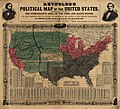
Datoteka:Reynolds's Political Map of the United States 1856.jpg
Prijeđi na navigaciju
Prijeđi na pretragu

Veličina ovog prikaza: 661 × 600 piksela. Druge rezolucije: 265 × 240 piksela | 529 × 480 piksela | 846 × 768 piksela | 1.128 × 1.024 piksela | 2.257 × 2.048 piksela | 7.813 × 7.090 piksela.
Izvorna datoteka (7.813 × 7.090 piksela, veličina datoteke/fajla: 19,76 MB, MIME tip: image/jpeg)
Historija datoteke
Kliknite na datum/vrijeme da biste vidjeli tadašnju verziju datoteke.
| Datum/vrijeme | Minijatura | Dimenzije | Korisnik | Komentar | |
|---|---|---|---|---|---|
| aktualna | 20:29, 16 august 2023 |  | 7.813 × 7.090 (19,76 MB) | Jengod | Autotune so brighter and easier to read |
| 09:28, 22 april 2016 |  | 7.813 × 7.090 (35,27 MB) | Khamar | Original improved in Adobe Photoshop by removing white strip through center where left and right sides of map join, removing some dark and white stripes from image, and nudging some of the text and lines back into alignment preserving as much of the ma... | |
| 03:40, 17 decembar 2012 |  | 7.828 × 7.090 (16,56 MB) | T3hBra1nWa5her | Higher resolution version from the [http://memory.loc.gov/cgi-bin/query/h?ammem/gmd:@field(NUMBER+@band(g3701e+ct000604)) Library of Congress Geography and Map Division Washington]. | |
| 15:15, 1 august 2008 |  | 2.000 × 1.736 (709 kB) | Bdamokos | {{Information |Description={{en|US map 1856 shows free and slave states and populations; this is "Reynolds's Political Map of the United States" (1856) from Library of Congress collection[http://lcweb2.loc.gov/ammem/aaohtml/exhibit/aopart3b.html] [[:en |
Upotreba datoteke
Sljedeća stranica koristi ovu datoteku:
Globalna upotreba datoteke
Ovu datoteku upotrebljavaju i sljedeći projekti:
- Upotreba na projektu ar.wikipedia.org
- Upotreba na projektu ca.wikipedia.org
- Upotreba na projektu de.wikipedia.org
- Upotreba na projektu en.wikipedia.org
- Upotreba na projektu en.wikiquote.org
- Upotreba na projektu es.wikipedia.org
- Upotreba na projektu fa.wikipedia.org
- Upotreba na projektu fi.wikipedia.org
- Upotreba na projektu fr.wikipedia.org
- Upotreba na projektu he.wikipedia.org
- Upotreba na projektu hu.wikipedia.org
- Upotreba na projektu id.wikipedia.org
- Upotreba na projektu it.wikipedia.org
- Upotreba na projektu ja.wikipedia.org
- Upotreba na projektu ko.wikipedia.org
- Upotreba na projektu no.wikipedia.org
- Upotreba na projektu pl.wikipedia.org
- Upotreba na projektu pt.wikipedia.org
- Upotreba na projektu ro.wikipedia.org
- Upotreba na projektu ru.wikipedia.org
- Upotreba na projektu simple.wikipedia.org