Datoteka:Pola - 32-45.jpg
Izvorna datoteka (3.581 × 4.932 piksela, veličina datoteke/fajla: 3,17 MB, MIME tip: image/jpeg)
|
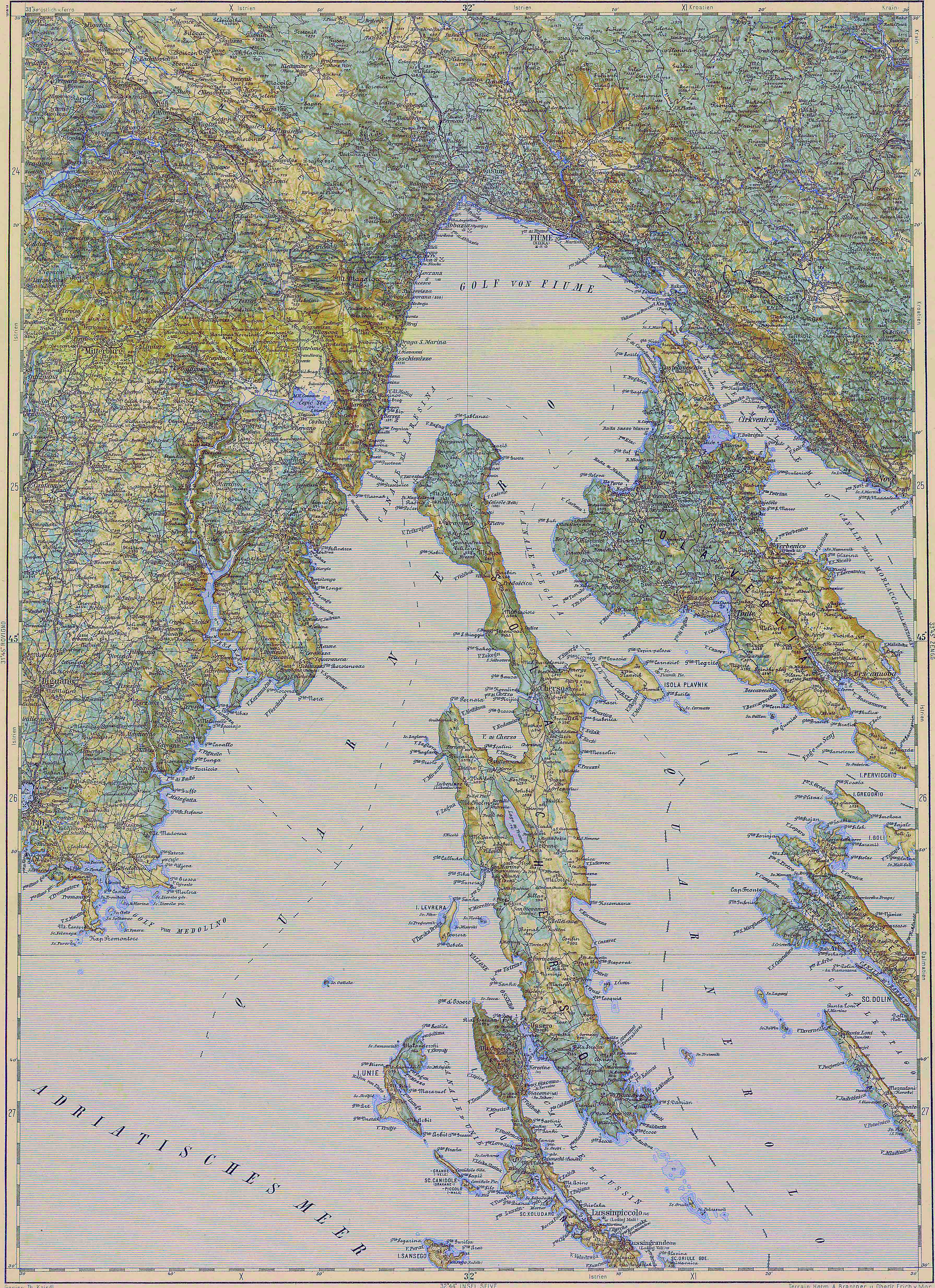
Deutsch: Blatt 32-45 der Generalkarte von Mitteleuropa 1:200.000 der Franzisco-Josephinischen Landesaufnahme, Österreich-Ungarn, ab 1887. Die Blattmitte liegt bei 45° n.Br. und 32° ö.L. (östlich von Ferro, nicht Greenwich!). English: Sheet 32-45 of the General Map of Central Europe, scale 1:200,000, edited 1887 ff. See 3rd Military Mapping Survey of Austria-Hungary for details. The center of the sheet is 45° North, 32° East (east of Ferro, not Greenwich!).
← Nachbarblätter. Klicken Sie auf eine Miniatur, um zu diesem Blatt zu gelangen.
← Neighbouring sheets. Click thumbnail to navigate |


.jpg)
Opis izmjene
| Opis | 3rd Military Mapping Survey of Austria-Hungary - Pola |
| Datum | oko 1910 |
| Izvor | http://lazarus.elte.hu/hun/moterkep.htm - László ZENTAI |
| Autor | Military mapping authority of Austria-Hungary |
Licenciranje
|
Ovo je djelo u javnom vlasništvu u zemlji podrijetla i u drugim zemljama s rokom trajanja autorskih prava za života autora plus 70 godina ili manje.
| |
| Ova datoteka je identificirana kao slobodna od poznatih ograničenja po zakonu o autorskim pravima, uključujući sva povezana i srodna prava. | |
Historija datoteke
Kliknite na datum/vrijeme da biste vidjeli tadašnju verziju datoteke.
| Datum/vrijeme | Minijatura | Dimenzije | Korisnik | Komentar | |
|---|---|---|---|---|---|
| aktualna | 08:40, 18 novembar 2007 | | 3.581 × 4.932 (3,17 MB) | Szilas | |
| 15:16, 14 mart 2007 |  | 3.581 × 4.932 (4,13 MB) | Szilas | == Összefoglaló == 3rd Military Mapping Survey of Austria-Hungary - Pola Source: http://lazarus.elte.hu/hun/moterkep.htm - László ZENTAI Category:3rd Military Mapping Survey of Austria-Hungary == Licensing == {{PD-old}} |
Upotreba datoteke
Sljedeća stranica koristi ovu datoteku:
Globalna upotreba datoteke
Ovu datoteku upotrebljavaju i sljedeći projekti:
- Upotreba na projektu de.wikivoyage.org
- Upotreba na projektu es.wikipedia.org
- Upotreba na projektu hu.wikipedia.org
- Upotreba na projektu hu.wikibooks.org
- Upotreba na projektu it.wikipedia.org
- Upotreba na projektu lt.wikipedia.org