Datoteka:Detailed map of Wakefield-Peacedale, Rhode Island.png
Prijeđi na navigaciju
Prijeđi na pretragu
Veća rezolucija nije dostupna.
Detailed_map_of_Wakefield-Peacedale,_Rhode_Island.png (575 × 425 piksela, veličina datoteke/fajla: 51 kB, MIME tip: image/png)
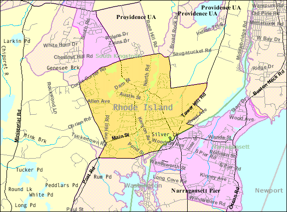
| Opis | Map of Wakefield-Peacedale, a census-designated place in the town of South Kingstown in Washington County, Rhode Island, United States, with its boundaries at the time of the 2000 census. | |||
| Datum | Nepoznat datum; downloaded by me on 29 December 2008 | |||
| Izvor | http://factfinder.census.gov/leg1/44/123071444.gif, from http://factfinder.census.gov | |||
| Autor | United States Census Bureau | |||
| Dopuštenje (Ponovna upotreba ove datoteke) |
|

Historija datoteke
Kliknite na datum/vrijeme da biste vidjeli tadašnju verziju datoteke.
| Datum/vrijeme | Minijatura | Dimenzije | Korisnik | Komentar | |
|---|---|---|---|---|---|
| aktualna | 16:46, 29 decembar 2008 | | 575 × 425 (51 kB) | Nyttend | {{Information |Description=Map of {{w|Wakefield-Peacedale, Rhode Island|Wakefield-Peacedale}}, a {{w|census-designated place}} in the town of {{w|South Kingstown, Rhode Island|South Kingstown}} in {{w|Washington County, Rhode Island|Washington County}}, { |
Upotreba datoteke
Sljedeća stranica koristi ovu datoteku:
Globalna upotreba datoteke
Ovu datoteku upotrebljavaju i sljedeći projekti:
- Upotreba na projektu ca.wikipedia.org
- Upotreba na projektu ceb.wikipedia.org
- Upotreba na projektu en.wikipedia.org
- Upotreba na projektu es.wikipedia.org
- Upotreba na projektu eu.wikipedia.org
- Upotreba na projektu fa.wikipedia.org
- Upotreba na projektu sr.wikipedia.org
- Upotreba na projektu tt.wikipedia.org
- Upotreba na projektu www.wikidata.org