Datoteka:Central and Eastern Europe around 950 AD.png
Prijeđi na navigaciju
Prijeđi na pretragu
Veća rezolucija nije dostupna.
Central_and_Eastern_Europe_around_950_AD.png (628 × 525 piksela, veličina datoteke/fajla: 272 kB, MIME tip: image/png)

Opis izmjene
| Opis |
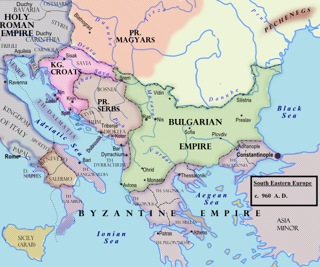
Български: Политическа география на сръбските земи при Чеслав Клонимирович.
English: Southeastern Europe around 950 AD
Español: Europa del Sudeste, hacia 960.
Français : Europe du Sud-Est vers 950 à la mort de Caslav.
Hrvatski: Jugoistočna Europa oko 950. godine.
Română: 950.
Српски / srpski: Оквирни приказ граница на Балкану (око 960. године), крајем Чаславове владавине. |
| Datum | 7. februar 2009. (izvorni datum postavljanja) |
| Izvor |
Prebačeno s en.wikipedia na Zajednički poslužitelj .
|
| Autor | Hxseek na Wikipedia na Engleski |
![[3]](http://www.lib.utexas.edu/maps/historical/shepherd/europe_byzantine_empires.jpg)
Licenciranje
| Ovaj rad je objavljen u javno vlasništvo od strane autora Hxseek na Wikipedia na Engleski. Ovo se primjenjuje širom svijeta. U nekim državama ovo zakonski nije moguće; u tom slučaju: Hxseek dopušta svima pravo korištenja ovog rada u bilo koju svrhu, bez ikakvih uslova, osim ako su takvi uslovi zakonski neophodni. |
Izvorna evidencija postavljanja
Izvorna stranica s opisom bila je ovdje. Niže navedena suradnička imena odnose se na en.wikipedia.
- 2009-02-07 03:50 Hxseek 628×525× (278873 bytes)
Historija datoteke
Kliknite na datum/vrijeme da biste vidjeli tadašnju verziju datoteke.
| Datum/vrijeme | Minijatura | Dimenzije | Korisnik | Komentar | |
|---|---|---|---|---|---|
| aktualna | 12:07, 26 mart 2009 | | 628 × 525 (272 kB) | Captain-tucker | {{Information |Description={{en|== Licensing: ==}} |Source=Transferred from [http://en.wikipedia.org en.wikipedia] |Date=2009-02-07 (original upload date) |Author=Original uploader was Hxseek at [http://en.wikipedia.org en.wikipedia] | |
Upotreba datoteke
Sljedećih 3 stranica koriste ovu datoteku:
Globalna upotreba datoteke
Ovu datoteku upotrebljavaju i sljedeći projekti:
- Upotreba na projektu azb.wikipedia.org
- Upotreba na projektu be-tarask.wikipedia.org
- Upotreba na projektu be.wikipedia.org
- Upotreba na projektu bg.wikipedia.org
- Upotreba na projektu el.wikipedia.org
- Upotreba na projektu en.wikipedia.org
- Upotreba na projektu es.wikipedia.org
- Upotreba na projektu et.wikipedia.org
- Upotreba na projektu fi.wikipedia.org
- Upotreba na projektu fr.wikipedia.org
- Upotreba na projektu gl.wikipedia.org
- Upotreba na projektu hu.wikipedia.org
- Upotreba na projektu it.wikipedia.org
- Upotreba na projektu lt.wikipedia.org
- Upotreba na projektu lv.wikipedia.org
- Upotreba na projektu mk.wikipedia.org
- Upotreba na projektu pl.wikipedia.org
- Upotreba na projektu pt.wikipedia.org
- Upotreba na projektu ro.wikipedia.org
- Upotreba na projektu ru.wikipedia.org
- Upotreba na projektu sl.wikipedia.org
- Upotreba na projektu sr.wikipedia.org
- Upotreba na projektu th.wikipedia.org
- Upotreba na projektu uk.wikipedia.org