Datoteka:1814 Thomson Map of the West Indies ^ Central America - Geographicus - WestIndies-t-1814.jpg
Prijeđi na navigaciju
Prijeđi na pretragu
Veličina ovog prikaza: 711 × 599 piksela. Druge rezolucije: 285 × 240 piksela | 569 × 480 piksela | 911 × 768 piksela | 1.215 × 1.024 piksela | 2.430 × 2.048 piksela | 5.000 × 4.215 piksela.
Izvorna datoteka (5.000 × 4.215 piksela, veličina datoteke/fajla: 4,41 MB, MIME tip: image/jpeg)
| John Thomson (kartograf): West Indies.
( |
|||||||||||||||||
|---|---|---|---|---|---|---|---|---|---|---|---|---|---|---|---|---|---|
| Umetnik |
|
||||||||||||||||
| Naslov |
West Indies. |
||||||||||||||||
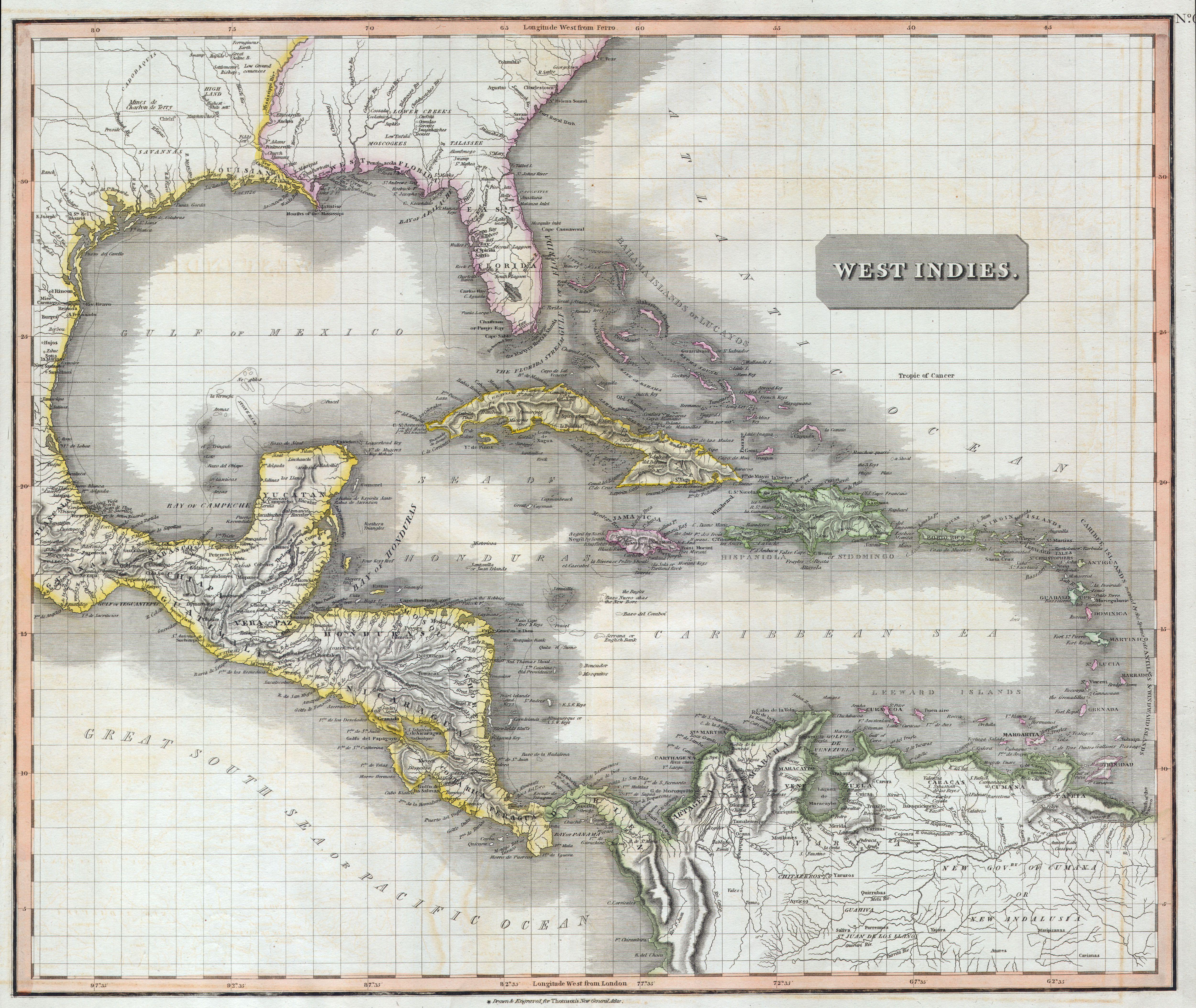
| Opis |
English: A masterpiece. This fascinating hand colored 1814 map by Edinburgh cartographer John Thomson depicts the West Indies and Central America. Covers from the Carolinas south through Texas, Mexico and central America to the northern part of South America as far as Venezuela and the Orinoco Delta. Includes all of the West Indies islands including the Caribbean and the Greater and Lesser Antilles. Extraordinarily details with notations on both physical and political features, as well as undersea elements, banks, and shoals. Notates several American Indian tribes in both North and South America. This map’s magnificent size, beautiful color, and high detail make this one of the finest maps of this region to appear in the early 19th century. |
||||||||||||||||
| Datum | 1814 | ||||||||||||||||
| Dimenzije | visina: 20 in (50,8 cm); širina: 24 in (60,9 cm) | ||||||||||||||||
| Popisni broj |
Geographicus link: WestIndies-t-1814 |
||||||||||||||||
| Izvor/fotograf |
|
||||||||||||||||
| Dopuštenje (Ponovna upotreba ove datoteke) |
|
||||||||||||||||
Historija datoteke
Kliknite na datum/vrijeme da biste vidjeli tadašnju verziju datoteke.
| Datum/vrijeme | Minijatura | Dimenzije | Korisnik | Komentar | |
|---|---|---|---|---|---|
| aktualna | 14:01, 24 mart 2011 | | 5.000 × 4.215 (4,41 MB) | BotMultichillT | {{subst:User:Multichill/Geographicus |link=http://www.geographicus.com/P/AntiqueMap/WestIndies-t-1814 |product_name=1814 Thomson Map of the West Indies & Central America |map_title=West Indies. |description=A masterpiece. This fascinating hand colored 181 |
Upotreba datoteke
Sljedeća stranica koristi ovu datoteku:
Globalna upotreba datoteke
Ovu datoteku upotrebljavaju i sljedeći projekti:
- Upotreba na projektu en.wikipedia.org
- Upotreba na projektu es.wikipedia.org
- Upotreba na projektu id.wikipedia.org
- Upotreba na projektu ru.wikipedia.org
- Upotreba na projektu uk.wikipedia.org