Datoteka:USA Indiana location map.svg
Prijeđi na navigaciju
Prijeđi na pretragu

Veličina ovog PNG-pregleda ove SVG-datoteke: 388 × 600 piksela. Druge rezolucije: 155 × 240 piksela | 310 × 480 piksela | 496 × 768 piksela | 662 × 1.024 piksela | 1.324 × 2.048 piksela | 776 × 1.200 piksela.
Izvorna datoteka (SVG fajl, nominalno 776 × 1.200 piksela, veličina fajla: 544 kB)
Opis izmjene
| Opis |
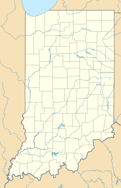
Quadratische Plattkarte, N-S-Streckung 130.0 %. Geographische Begrenzung der Karte:
Equirectangular projection, N/S stretching 130.0 %. Geographic limits of the map:
Ova je slika napravljena programom GeoTools. |
| Datum | |
| Izvor | Vlastito djelo |
| Autor | Alexrk2 |
| Ostale verzije |
Radovi izvedeni od ove datoteke: BMO Harris Bank 2012-06.png Radovi izvedeni od ove datoteke: |

|
This map has been made or improved in the German Kartenwerkstatt (Map Lab). You can propose maps to improve as well.
|
Licenciranje
Ja, vlasnik autorskog prava ovog djela, ovdje ga objavljujem pod sljedećim licencama:

|
Dopušteno je umnožavanje, dijeljenje i mijenjanje ovog dokumenta pod uslovima GNU-ove licence za slobodnu dokumentaciju, verzije 1.2 ili bilo koje novije koju objavi Fondacija za slobodni softver; bez nepromjenljivih odjeljaka i bez tekstova na naslovnoj i zadnjoj strani. Tekst licence možete pročitati ovdje. |
Ova datoteka je licencirana pod Creative Commons Attribution 3.0 neportiranom licencom.
- Slobodno smijete:
- dijeliti – umnožavati, raspodjeljivati i prenositi djelo
- prerađivati – prilagođavati djelo
- Pod sljedećim uslovima:
- pripisivanje – Morate pripisati odgovarajuće autorske zasluge, osigurati link ka licenci i naznačiti jesu li napravljene izmjene. To možete uraditi na bilo koji razumni način, ali ne tako da se sugerira da davalac licence odobrava Vas ili Vašu upotrebu njegovog djela.
Možete odabrati licencu po vašem izboru.
Historija datoteke
Kliknite na datum/vrijeme da biste vidjeli tadašnju verziju datoteke.
| Datum/vrijeme | Minijatura | Dimenzije | Korisnik | Komentar | |
|---|---|---|---|---|---|
| aktualna | 20:51, 16 novembar 2012 | | 776 × 1.200 (544 kB) | Alexrk2 | removed crisp-edges |
| 18:13, 9 juli 2009 |  | 776 × 1.200 (544 kB) | Alexrk2 | == Beschreibung == {{Information |Description= {{de|Positionskarte von Indiana, USA}} Quadratische Plattkarte, N-S-Streckung 130.0 %. Geographische Begrenzung der Karte: * N: 42.0° N * S: 37.6° N * W: 88.3° W * O: 84.6° W { |
Upotreba datoteke
Sljedećih 88 stranica koriste ovu datoteku:
- Aberdeen, Indiana
- Arlington, Indiana
- Avoca, Indiana
- Butlerville, Indiana
- Canaan, Indiana
- Clarksburg, Indiana
- Coalmont, Indiana
- Cordry Sweetwater Lakes, Indiana
- Country Squire Lakes, Indiana
- De Motte, Indiana
- Deputy, Indiana
- Dresser, Indiana
- Dubois, Indiana
- East Enterprise, Indiana
- Emison, Indiana
- Fish Lake, Indiana
- Florence, Indiana
- Freetown, Indiana
- Georgetown, Floyd County, Indiana
- Georgetown, St. Joseph County, Indiana
- Grissom Air Force Base, Indiana
- Hanna, Indiana
- Harlan, Indiana
- Harrodsburg, Indiana
- Hatfield, Indiana
- Hayden, Indiana
- Herbst, Indiana
- Heritage Lake, Indiana
- Highland, Lake County, Indiana
- Highland, Vanderburgh County, Indiana
- Hoagland, Indiana
- Howe, Indiana
- Hudson Lake, Indiana
- Idaville, Indiana
- Indianapolis, Indiana
- Jalapa, Indiana
- Kent, Indiana
- Kimmell, Indiana
- La Crosse, Indiana
- Lake Holiday, Indiana
- Lake Santee, Indiana
- Laketon, Indiana
- Landess, Indiana
- Manilla, Indiana
- Metamora, Indiana
- Mier, Indiana
- Milford, Decatur County, Indiana
- Milford, Kosciusko County, Indiana
- Milroy, Indiana
- Monroe, Indiana
- Mount Auburn, Indiana
- New Trenton, Indiana
- Notre Dame, Indiana
- Otwell, Indiana
- Owensburg, Indiana
- Painted Hills, Indiana
- Parkers Settlement, Indiana
- Pine Village, Indiana
- Point Isabel, Indiana
- Pottawattamie Park, Indiana
- Purdue University, Indiana
- Raglesville, Indiana
- Ragsdale, Indiana
- Richland, Indiana
- Rolling Prairie, Indiana
- Salt Creek Commons, Indiana
- Scipio, Indiana
- Scotland, Indiana
- Shelby, Indiana
- Shorewood Forest, Indiana
- Sims, Indiana
- Smithville-Sanders, Indiana
- Somerset, Indiana
- St. Bernice, Indiana
- St. Joe, Indiana
- St. Leon, Indiana
- St. Mary of the Woods, Indiana
- St. Meinrad, Indiana
- State Line City, Indiana
- Vallonia, Indiana
- Van Bibber Lake, Indiana
- Waldron, Indiana
- West Lebanon, Indiana
- Westphalia, Indiana
- Wheeler, Indiana
- Williams, Indiana
- Windfall City, Indiana
- Šablon:Location map USA Indiana
Globalna upotreba datoteke
Ovu datoteku upotrebljavaju i sljedeći projekti:
- Upotreba na projektu af.wikipedia.org
- Upotreba na projektu an.wikipedia.org
- Upotreba na projektu ar.wikipedia.org
- Upotreba na projektu azb.wikipedia.org
- پلستاین، ایندیانا
- وستفالیا، ایندیانا
- متامورا، ایندیانا
- لئوپولد، ایندیانا
- کنن، ایندیانا
- پوینت ایزابل، ایندیانا
- کوردری سویتواتر لیکس، ایندیانا
- بون قروو، ایندیانا
- سمیز، اندیانا
- میر، ایندیانا
- هالاپا، ایندیانا
- دپیوتی، ایندیانا
- لندس، ایندیانا
- لیک سانتی، ایندیانا
- راقلزویل، ایندیانا
- کریت، ایندیانا
- کانتری اسکوایر لیک، ایندیانا
- دیرفیلد، ایندیانا
- متز، ایندیانا
- هربست، ایندیانا
- بر لیک، ایندیانا
- لااتو، ایندیانا
- بیرمینقهام، ایندیانا
- وایات، ایندیانا
- لیک هارت، ایندیانا
- اوربانا، ایندیانا
- استیوارت، ایندیانا
- هدریک، ایندیانا
- کاربوندیل، ایندیانا
- سیپیو، ایندیانا
- کلیرکریک، ایندیانا
- چامبرزبورق، ایندیانا
- کول سیتی، ایندیانا
- فریندشیپ، ایندیانا
- هایدن، ایندیانا
- ابی، ایندیانا
- فالدا، ایندیانا
- اونزبرق، ایندیانا
- نوتر دام، ایندیانا
- رولینق پرایری، ایندیانا
- شلبی، ایندیانا