Datoteka:Northumberland UK location map.svg
Prijeđi na navigaciju
Prijeđi na pretragu

Veličina ovog PNG-pregleda ove SVG-datoteke: 499 × 599 piksela. Druge rezolucije: 200 × 240 piksela | 400 × 480 piksela | 639 × 768 piksela | 853 × 1.024 piksela | 1.705 × 2.048 piksela | 1.120 × 1.345 piksela.
Izvorna datoteka (SVG fajl, nominalno 1.120 × 1.345 piksela, veličina fajla: 1,68 MB)
| Opis |
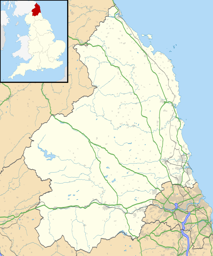
Map of Northumberland, UK with the following information shown:
Equirectangular map projection on WGS 84 datum, with N/S stretched 170% Geographic limits:
|
| Datum | |
| Izvor |
|
| Autor | Nilfanion, created using Ordnance Survey data |
| Dopuštenje (Ponovna upotreba ove datoteke) |
Ova datoteka dostupna je pod licencom Creative Commons Attribution-Share Alike 3.0 Unported licencom. Pripisivanje: Contains Ordnance Survey data © Crown copyright and database right
|
| Ostale verzije | File:Northumberland UK district map (blank).svg - Blank map |
.svg)
Historija datoteke
Kliknite na datum/vrijeme da biste vidjeli tadašnju verziju datoteke.
| Datum/vrijeme | Minijatura | Dimenzije | Korisnik | Komentar | |
|---|---|---|---|---|---|
| aktualna | 21:08, 26 septembar 2010 | | 1.120 × 1.345 (1,68 MB) | Nilfanion | {{Information |Description=Map of Northumberland, UK with the following information shown: *Administrative borders *Coastline, lakes and rivers *Roads and railways *Urban areas Equirectangular map projection on WGS 84 datum, with N/S |
Upotreba datoteke
Sljedeća stranica koristi ovu datoteku:
Globalna upotreba datoteke
Ovu datoteku upotrebljavaju i sljedeći projekti:
- Upotreba na projektu ar.wikipedia.org
- Upotreba na projektu bg.wikipedia.org
- Upotreba na projektu ceb.wikipedia.org
- Upotreba na projektu de.wikipedia.org
- Upotreba na projektu en.wikipedia.org
- Churnsike Lodge
- Lindisfarne
- Bamburgh
- Berwick-upon-Tweed
- Dunstanburgh Castle
- Craster
- Embleton, Northumberland
- Alnwick
- Alnwick Castle
- Edlingham Castle
- Seahouses
- Farne Islands
- Belford, Northumberland
- Branxton, Northumberland
- Beal, Northumberland
- Prudhoe
- Corbridge
- Hexham
- Bedlington
- Rothbury
- Wooler
- Amble
- Morpeth, Northumberland
- Ancroft
- Islandshire
- Blyth, Northumberland
- Coquet Island
- Cramlington
- Newbiggin-by-the-Sea
- Fusiliers Museum of Northumberland
- Battle of Hedgeley Moor
- Kielder Forest
- Stakeford
- Hexhamshire
- Norham
- Warkworth, Northumberland
- Bamburgh Castle
- Howick house
- RAF Boulmer
- Morpeth railway station
- Ellington, Northumberland
- Etal Castle
- Seaton Delaval Hall
- Haltwhistle
- Sinderhope
- Allendale, Northumberland