Datoteka:1798 Cassini Map of Alaska and the Bering Strait - Geographicus - Alaska-cassini-1798.jpg
Prijeđi na navigaciju
Prijeđi na pretragu
Veličina ovog prikaza: 800 × 579 piksela. Druge rezolucije: 320 × 232 piksela | 640 × 464 piksela | 1.024 × 742 piksela | 1.280 × 927 piksela | 2.560 × 1.854 piksela | 4.000 × 2.897 piksela.
Izvorna datoteka (4.000 × 2.897 piksela, veličina datoteke/fajla: 3,09 MB, MIME tip: image/jpeg)
| Le Coste Nord Ovest Dell' America e Nord Est Dell' Asia Delineate sulle ultime Osservazioni del Cp. Cook. | ||||||
|---|---|---|---|---|---|---|
| Umetnik | ||||||
| Naslov |
Le Coste Nord Ovest Dell' America e Nord Est Dell' Asia Delineate sulle ultime Osservazioni del Cp. Cook. |
|||||
| Opis |
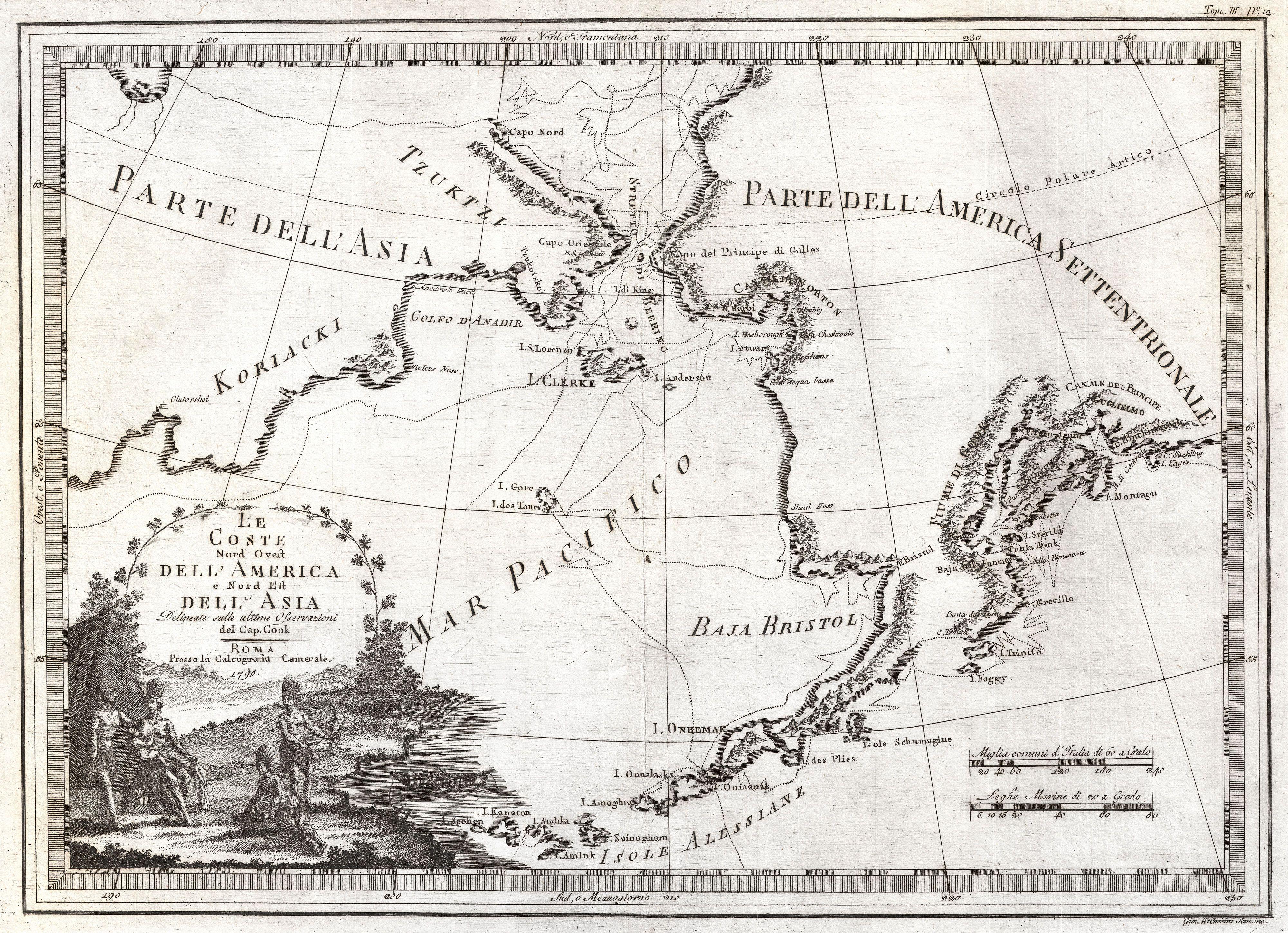
English: An extraordinarily fine example of Cassini's 1798 map of Alaska, the Bering Strait, and Siberia. Cassini issued this map in his 1798 atlas to illustrate the discoveries made by James Cook. Cook was the first to accurately chart the Alaskan coastline and provide a detailed mapping of the Aleutian Islands. Cook's zigzagging route is shown as he skirts the Aleutian Islands, passes through the Bering Strait into the Arctic Ocean, and then turns back to sail south along the Siberian Coast. Here the Aleutians are collectively identified as Isole Alessiane, though many of the original islands are clearly given indigenous names. A large decorative cartouche in the lower left depicts four American Indians and a baby. This is perhaps the most beautiful of the many maps designed to illustrate Cook's voyages. |
|||||
| Datum | 1798 (dated) | |||||
| Dimenzije | visina: 14,5 in (36,8 cm); širina: 20 in (50,8 cm) | |||||
| Popisni broj |
Geographicus link: Alaska-cassini-1798 |
|||||
| Izvor/fotograf |
Cassini, Giovanni Maria, Nuovo Atlante Geografico Universale Delineato Sulle Ultime Osservazioni, V. 3, Rome: Calcogrfia camerale, 1798.
|
|||||
| Dopuštenje (Ponovna upotreba ove datoteke) |
|
|||||
Historija datoteke
Kliknite na datum/vrijeme da biste vidjeli tadašnju verziju datoteke.
| Datum/vrijeme | Minijatura | Dimenzije | Korisnik | Komentar | |
|---|---|---|---|---|---|
| aktualna | 20:26, 24 mart 2011 | | 4.000 × 2.897 (3,09 MB) | BotMultichillT | {{subst:User:Multichill/Geographicus |link=http://www.geographicus.com/P/AntiqueMap/Alaska-cassini-1798 |product_name=1798 Cassini Map of Alaska and the Bering Strait |map_title=Le Coste Nord Ovest Dell' America e Nord Est Dell' Asia Delineate sulle ultim |
Upotreba datoteke
Sljedeća stranica koristi ovu datoteku:
Globalna upotreba datoteke
Ovu datoteku upotrebljavaju i sljedeći projekti:
- Upotreba na projektu avk.wikipedia.org